New stand alone Watch App
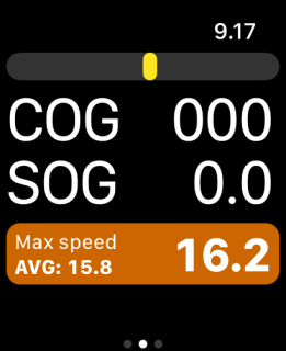
iRegatta Watch has been released.
This is a stand alone Watch App, especially targeting Dinghy and small boat sailors. With the new Apple Watch Ultra, we finally have a device that can have the GPS running for a full day of racing, and with the new Action button, the app can also be operated while the "Water Lock" is active.
Read more about it, and how to operate it with the Action Button, in the User Instructions here.
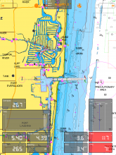
iRegatta and iRegatta Pro now supports Navionics maps
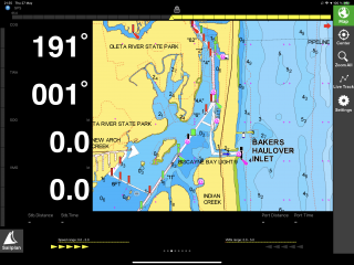
With the new version 4.50.0 of iRegatta and iRegatta Pro, you will be able to use Navionics maps.
You of cause need a Navionics subscription to access your maps. In the leftmost view there is a Navionics button you need to tap to login to your Navionics account, and then you’ll have access to your Navionics maps.
Wärtsilä maps will be discontinued
Wärtsilä has taken the decision to withdraw the WMS service (which iRegatta uses to get the maps) as a commercial product.
This means that you no longer can start new subscription or renew existing subscriptions of Wärtsilä maps in iRegatta, iRegatta Pro nor iRegatta2.
For those who have existing subscriptions, Wärtsilä will still keep the content available for the rest of existing subscription time, and will strive to come with additional information before October, about future plans.
iRegatta now supports the Airmar DST810 Bluetooth multisensor
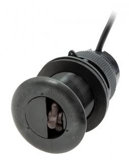
With iRegatta2 version 1.14.0 and iRegatta/iRegatta Pro version 4.43.0 the Airmar DST810 Multisensor can now connect directly using BTLE to provide Depth, Speed through Water, Water temperature and Attitude (Pitch/Roll) data to the app.
If you have a NMEA2000 system you can hook it up to that, but even without, simply supply the DST810 with 12V and you can get the data into iRegatta using BTLE.
Use the Airmar CAST™ app to calibrate the sensor, and after that, you're good to go.
New "Race Control" feature in iRegatta2
The Race Control feature will allow several iPads to connect and let a Race Committee remote controll the participants start count down, share wind information (if the participants don't have NMEA wind data) and even set out a race course boundary, as you've seen it in the Americas Cup or the SailGP series.
Read more about it in the users manual.
https://www.zifigo.com/node/673#racecontrol
iRegatta2 now supports Navionics map
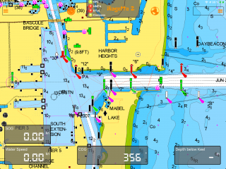
From version 1.10.0 iRegatta supports Navionics maps.
See more about differences to the existing (and still supported) Wärtsilä maps, and how to use Navionics in the users manual here: https://www.zifigo.com/node/673#maps
Map flickering finally fixed
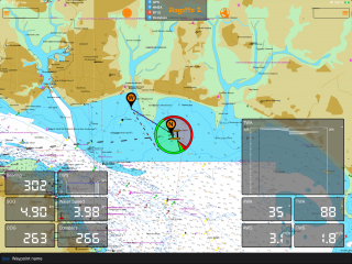
With iOS 13.2 Apple introduced a problem for apps like iRegatta and iRegatta2 that use third party maps. When ever overlaying graphics like bearing og laylines updated, the underlaying map tiles where flickering/reloading.
With the resently released iOS 13.4 this problem finally has been fixed.
iRegatta2 and Navionics beta test
Is there anybody out there who has iRegatta2 and a Navionics subscription on their iPad, who would help beta testing the usage of Navionics charts in iRegatta2?
If so, please send a mail to info@zifigo.com
- Read more about iRegatta2 and Navionics beta test
- Log in to post comments
iRegatta 2 Users Manual
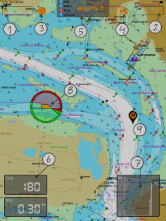
I finally got around to start on a Users Manual for iRegatta 2. It’s still a work in progress, but hopefully it’ll help to get start with iRegatta 2.
It can be found under iRegatta 2 on zifigo.com
New map option for iRegatta2
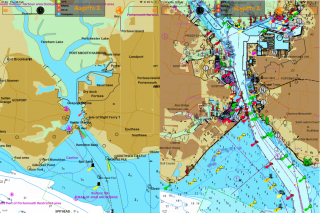
With version 1.05.0 of iRegatta2 comes the option for an alternative Wärtsilä map, if you have a wärtsilä map subscription in iRegatta2.
Besides the existing maps (Wärtsilä Auxiliary), that have been available so far, comes "Wärtsilä Main" as an alternative. Go to settings to switch between the two, and find out which one suits your needs the best.

